


Antique Folding London Map, English, Cartography, Historic, Georgian, Dated 1783
Delivery Quote Request
Please fill in the form below to request a delivery quote from London Fine Ltd.
Contact London Fine Ltd
 Hele, United Kingdom
Simply fill in the below form to get in touch with London Fine Ltd regarding this item.
About this item
Our Stock # 18.8741
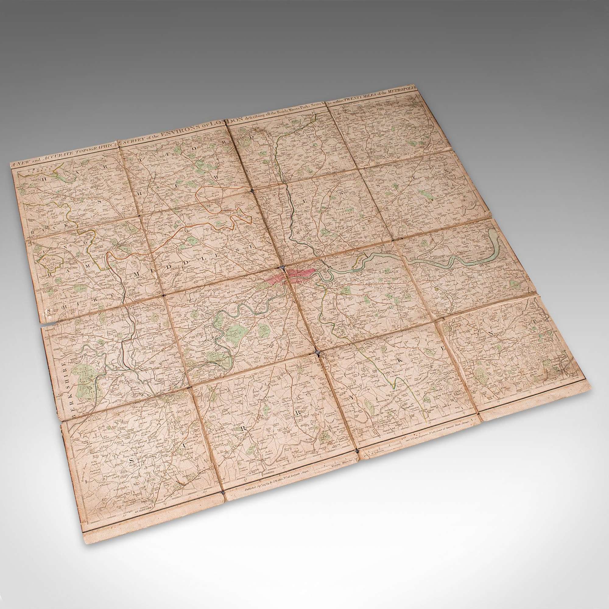
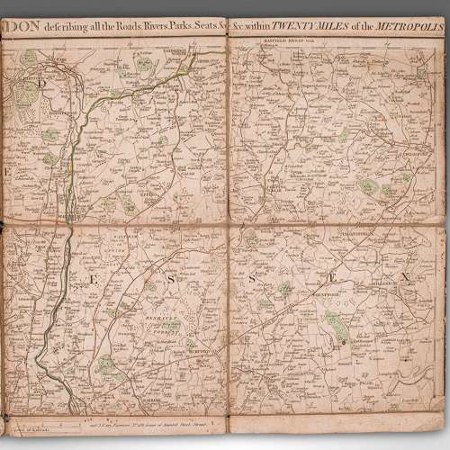
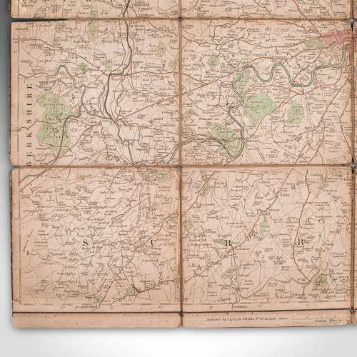
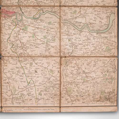
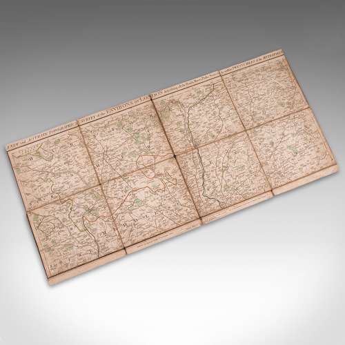
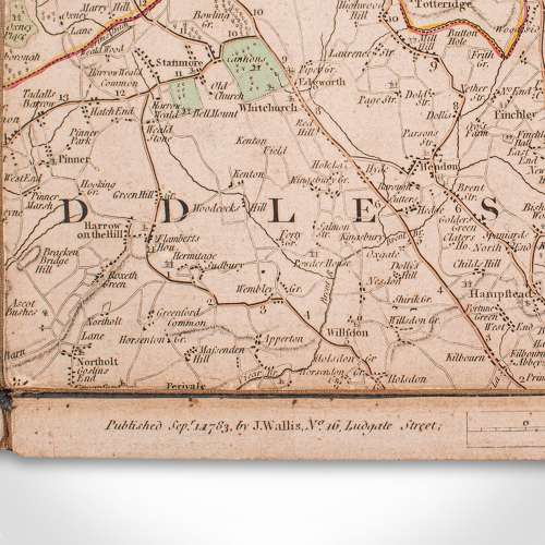
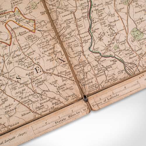
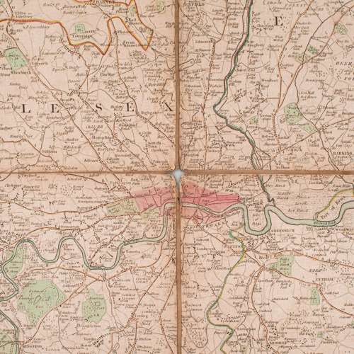
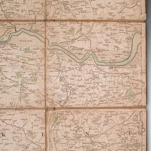
This is an antique folding London map. An English, paper on linen cartographical study of the London metropolis and the surrounding area, published in the mid Georgian period, dated 1783.
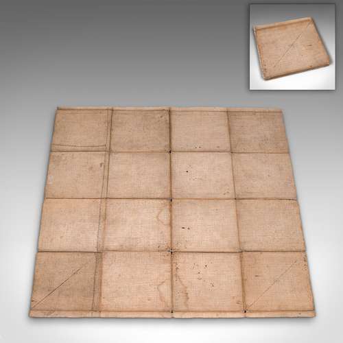
Fascinating cartographic record of London in the late 18th century Displays a desirable aged patina and in delicate, but legible order Published on paper and mounted upon linen for posterity Across sixteen square sections, the map gently folds into one City of London accentuated in red, with the Thames and other rivers in light blue Similarly, London's parks are accentuated in green Annotated for County, Town and Borough names, as they stood in September 1873 Published by John Wallis of 16 Ludgate Street London, at a scale of 69.75 statute miles to a degree of latitudeThis is a superb antique folding map of London, with excellent detail of how the capital and the South East stood in the 1780s. Of delicate age, but delightfully legible, the map is ideal for framing. Delivered ready to enjoy.
Dimensions:
Folded Width: 15.5cm (6'')
Folded Depth: 1.5cm (.5'')
Folded Height: 16cm (6.25'')
Unfolded Width: 64.5cm (25.5'')
Unfolded Depth: 0.5cm (.25'')
Unfolded Height: 58cm (22.75'')
Additional Information
18.8741 (AB-134297)
W: 15cm (5.9")H: 16cm (6.3")D: 1cm (0.4")L: 15cm (5.9")
Georgian (1714 to 1837)
![]() Hele, United Kingdom
Hele, United Kingdom
We are a team passionate about antiques and customer service – please do read the reviews on our website; https://www.londonfine.co.uk/pages/reviews Please do email us, call or drop in and see us, we'd love to hear from you.


