


Antique Georgian Grand Tour Folding Map of Italy, Sicily, Sardinia etc
Delivery Quote Request
Please fill in the form below to request a delivery quote from Tregeagle Fine Art.
Contact Tregeagle Fine Art
 Oxfordshire, United Kingdom
Simply fill in the below form to get in touch with Tregeagle Fine Art regarding this item.
About this item
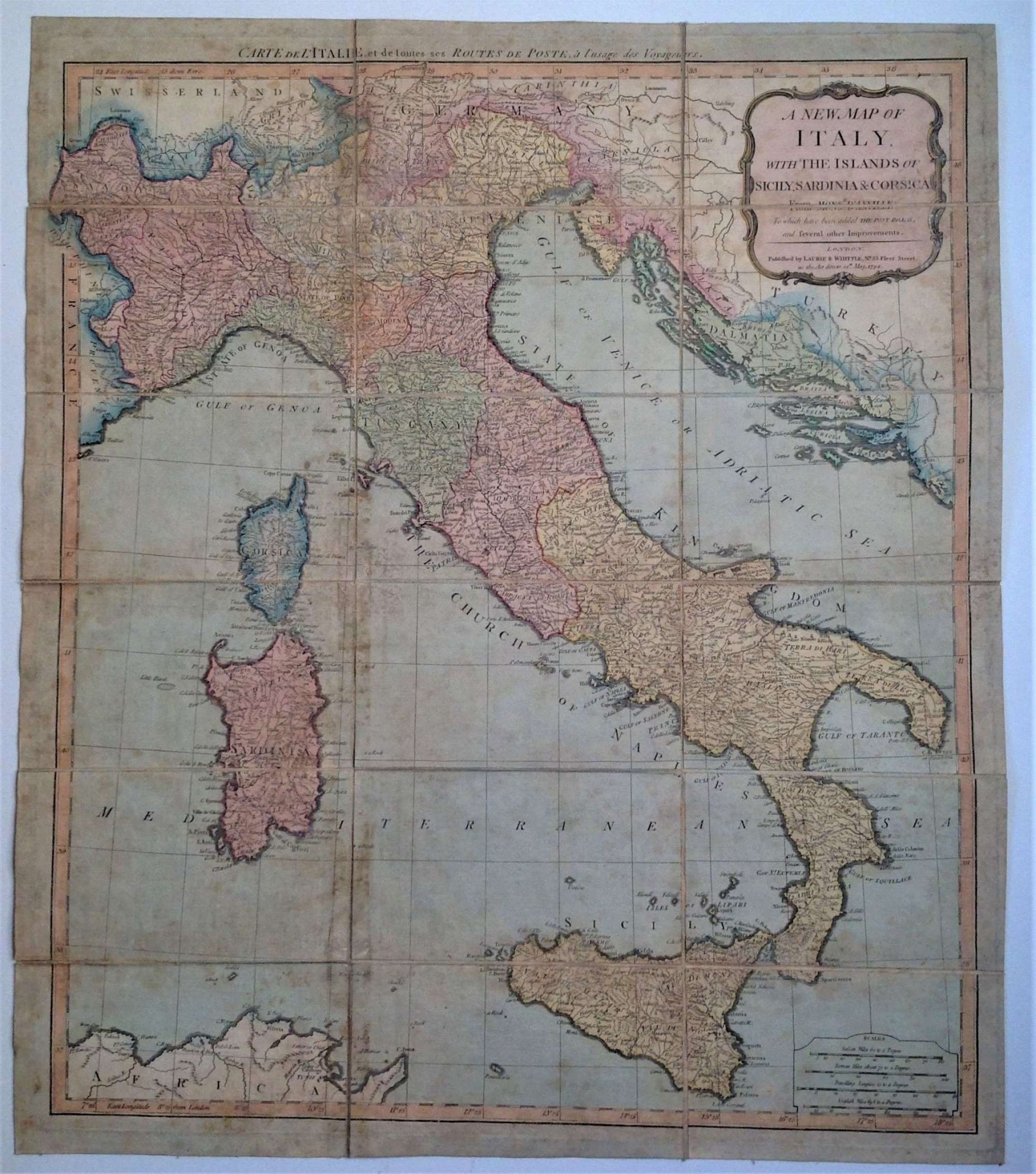
"A New Map of Italy, with the islands of Sicily, Sardinia & Corsica"
Linen backed, folding into its original marbled paper sleeve
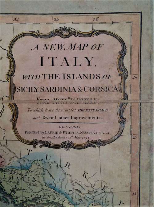
Published by Laurie & Whittle, London, 1794
Retailed, circa 1823, by James Wyld Sr. (1790–1836)
Measures:-
Open: 63 cm high by 54 cm wide
Folded: 19 cm high by 11.3 cm wide
"A new map of Italy, with the islands of Sicily, Sardinia & Corsica, From Monsr. d'Anville: To which have been added the Post Roads and several other improvements. London; Published by Laurie & Whittle, No.53 Fleet Street, as the Act directs 12th May, 1794"
A decorative 18th-Century large-format map of Italy, Sicily, Corsica and Sardinia etc by one of England's leading firms of cartographers firms and retailed in London by James Wyld Sr. (successor to Mr. Faden "Geographer to His Majesty") of Charing Cross, opposite Northumberland House.
A folding, linen backed, engraved travel map with extensive original hand-colouring, divided across 16 panels, which fold to fit into the original card slipcase/sleeve. Marbled paper ends to the folded map, the card slipcase covered with the same marbled paper. Original label to the slipcase with the retailer's name and address. Paper toned, slight wear to folds in linen, map in very good condition, marbled card slipcase, rubbed around edges with loss of paper to corners.
An attractive map and one which would have been invaluable to an early 19th Century "Grand Tourist".
Additional Information
10271 (AB-51214)
W: 54cm (21.3")H: 63cm (24.8")
Georgian (1714 to 1837)
![]() Oxfordshire, United Kingdom
Oxfordshire, United Kingdom


 Mezzotint Portrait, Published 1722")

 “Scene with Bridge, Stream & Figure”")
 Mezzotint after Lemuel Francis Abbott")