


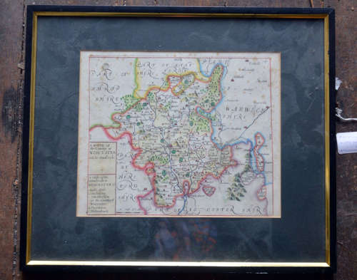
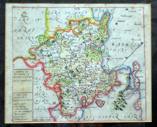
1718 "a Mapp Of The County Of Worcester With Its Hundreds" By Blome A/f
Delivery Quote Request
Please fill in the form below to request a delivery quote from Heatons of Tisbury.
Contact Heatons of Tisbury
 Wiltshire, United Kingdom
Simply fill in the below form to get in touch with Heatons of Tisbury regarding this item.
About this item
Original hand coloured copper engraved Printed map. Worcestershire'A Mapp of the county of Worcester with its hundreds' Finely engraved map of the county by Richard Blome from the atlas "England Exactly Described or a Guide to Travellers…" first published by Thomas Taylor, but from the later edition published by Thomas Bakewell. A major addition to the earlier plates is that roads and distances between towns are now included, after the road surveys of John Ogilby. Older colour last image is lightened to allow reading
**CONDITION ISSUES** Slight spotting/foxing so cheaper easily sorted. Framed, but very dusty as located at the back of the store, folds as issued 34.1 x 40 cm size of the frame *
Additional Information
AB-186730
W: 27cm (10.6")H: 23cm (9.1")
18th Century, Georgian (1714 to 1837)
British
![]() Wiltshire, United Kingdom
Wiltshire, United Kingdom
We are dealers in original antique prints and artwork trading for over 20 years. Stock is mainly unframed and sold to the trade and decorators worldwide. Stock prints from the 17th. to the 19th. centuries cover a wide range of subjects and are subdivided into sections on the shop website
 antique map of “Pembrokeshire”, circa 1750")

 Gall & Inglis Edinburgh")


