

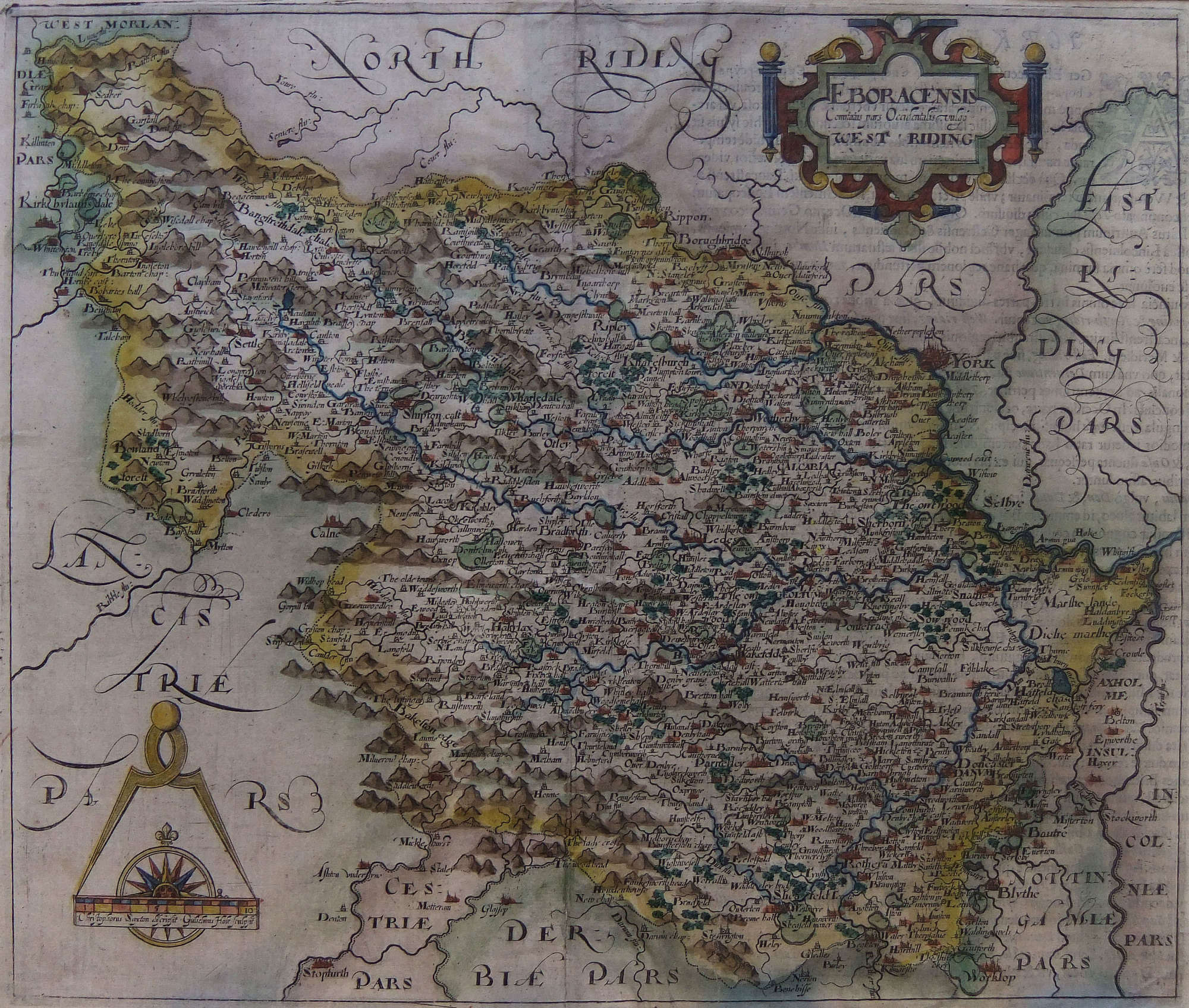

Saxton Hole "West Riding of Yorkshire" 17th century map
SOLD
Although this item has been sold, we have a range of similar items that may be of interest to you.
View similar items
Delivery Quote Request
Please fill in the form below to request a delivery quote from McTague of Harrogate.
Contact McTague of Harrogate
 North Yorkshire, United Kingdom
Simply fill in the below form to get in touch with McTague of Harrogate regarding this item.
About this item
This lovely old map of the West Riding of Yorkshire dates from the 17th century. It is a copper-plate engraving with fine original colour. Measuring 11"x 13" this fine old Yorkshire map is mounted giving an overall size of 15"x 17". It is unframed.
Additional Information
10827 (AB-108731)
W: 13" (33 cm)H: 11" (27.9 cm)
17th Century
![]() North Yorkshire, United Kingdom
North Yorkshire, United Kingdom
McTague of Harrogate was opened in 1981 by Paul McTague who has run the gallery since with help and advice from family members Melanie, Emma and Robert. From an early age Paul was brought up surrounded by pictures and artists. This sowed the seed of interest which has grown into his current...


![“Le Congrès De Paris, Mars [March] 1856”, Historic Crimean War Print](upload/images/shopprod/121896/-le-congr-s-de-paris-mars-march-1856-historic-crimean-war-print_121896_pic1_size2.jpg "“Le Congrès De Paris, Mars [March] 1856”, Historic Crimean War Print")
")


