


Antique Oarsman's Map Of The River Thames, English, Cartography, Published 1912
Delivery Quote Request
Please fill in the form below to request a delivery quote from London Fine Ltd.
Contact London Fine Ltd
 Hele, United Kingdom
Simply fill in the below form to get in touch with London Fine Ltd regarding this item.
About this item
Our Stock # 18.9531
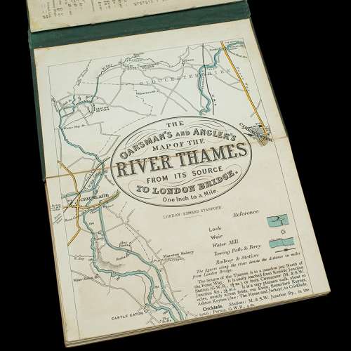
This is an antique copy of The Oarsman's and Angler's Map of the River Thames - New Edition. An English, bound map book, published in English by Edward Stanford, London, this new edition published in 1912.
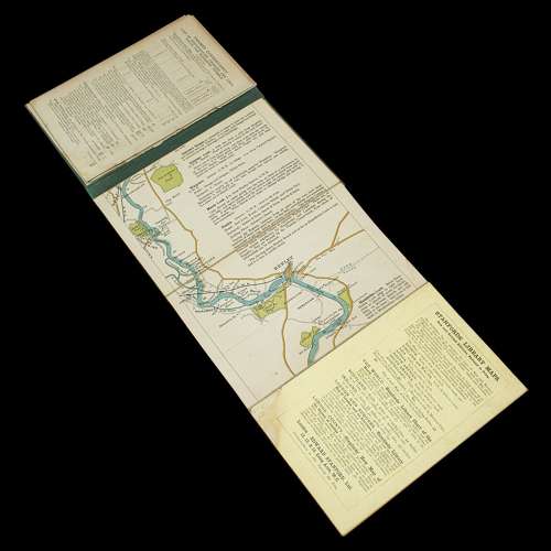
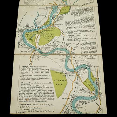
Delightfully illustrated map charting the River Thames from its source in Kemble, Gloucestershire to London Bridge at a scale of one inch to a mile. Printed in colour and with a reference key that shows locks, weirs and railways et al. This new edition was published by Edward Stanford Limited of Long Acre, London.
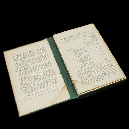
Displays a time worn appearance, the initial pages present, but loose The fold out map in very good antique condition commensurate with age Bound in a green canvas over board, the titling in gilt finish Across 25 pages spanning over 9 feet, the Thames map unfolds to a length of 2.83m (111.5'') Along the map, the notes add riparian detail of boathouses and innsThis is a fascinating antique copy of The Oarsman's and Angler's Map of the River Thames. The fold-out map at a length of over 9 feet is astonishing and a treat to read from. Delivered ready to enjoy.
Dimensions:
Max Width: 11cm (4.25'')
Max Depth: 1.5cm (.5'')
Max Height: 16.5cm (6.5'')
Map Unfolded: 283cm (111.5'')
Additional Information
18.9531 (AB-150397)
W: 11cm (4.3")H: 16cm (6.3")D: 1cm (0.4")L: 11cm (4.3")
Early 20th Century
![]() Hele, United Kingdom
Hele, United Kingdom
We are a team passionate about antiques and customer service – please do read the reviews on our website; https://www.londonfine.co.uk/pages/reviews Please do email us, call or drop in and see us, we'd love to hear from you.


, County Map of Somerset, Circa 1607")


